South Australia-developed HyperScout 2 Flight Model hyperspectral imaging camera is ready to be integrated into the state’s space-bound Kanyini satellite.
Its presence in space will provide to government and non-government agencies critical data for more informed decision making in water usage, climate policy and disaster management.
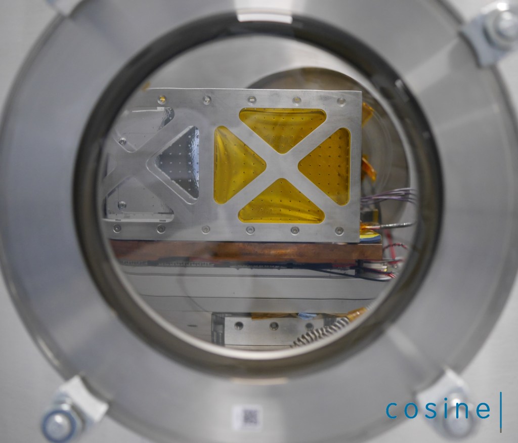
The HyperScout 2 is a three-in-one instrument that combines hyperspectral and thermal imaging with high-level data processing and artificial intelligence (AI) capabilities. It can provide hyperspectral imaging in the visible and near infrared to analyse the composition of the Earth, along with three thermal infrared bands to retrieve temperature distribution.
The launch of the satellite is part of South Australia Space Sector Strategy 2030 and is Australia’s first state-based satellite.
The South Australian Government is investing A$6.5 million in the SA Space Services Mission. SmartSat Cooperative Research Centre (CRC) is leading the mission and application prototyping, with Adelaide-based satellite manufacturing company Inovor Technologies designing and building the satellite and South Australian space company Myriota contracted for the Internet of Things space services.
“The spectral range of HyperScout 2 enables an extremely detailed analysis of land cover, supporting research into crop health, forests, inland water and coasts. The thermal infrared imager will provide vital information on heat generators in South Australia. In parallel with the development phase, SmartSat is formulating a research programme with our partners to make optimal use of the systems once in orbit,” said Peter Nikoloff, Kanyini Mission Director of SmartSat.
“We have completed all the necessary activities for the delivery of the HyperScout Flight Model, and we now look forward to supporting our customer during the next project steps. We are proud to provide the core sensing device for this top-level Australian mission,” said Marco Esposito, Managing Director of cosine Remote Sensing,.
SmartSat CRC has evaluating using Kanyini’s hyperspectral data for crop classification while other research groups are considering applications of the AI module for bushfire smoke detection, monitoring water quality and advanced analytics for defence and security.
